Self-guided audio tour in Innsbruck
Start Free on iPhone
Start free on iPhone to unlock this self-guided walking tour in Innsbruck. Hear all the stories that make it amazing, walk at your own pace, and begin whenever you want.
Your Private Tour Guide
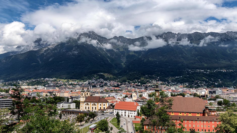
Discover the most visually stunning corners of Innsbruck on this self-guided walking route that traces the banks of the emerald-green Inn River. Innsbruck is a city where jagged limestone peaks serve as a permanent backdrop to imperial grandeur and modern design, making it a dream destination for those with a lens in hand. This neighborhood stroll focuses on the Mariahilf district and the riverside paths, offering a perspective of the city that many visitors miss while staying confined to the central Altstadt. Starting in the lush, manicured grounds of the Innsbrucker Hofgarten, you will explore the intersection of nature and history. The route quickly transitions from the green serenity of the imperial gardens to the avant-garde architecture of the Hungerburgbahn station, designed by the legendary Zaha Hadid. These contrasting textures—the soft organic curves of the mountains and the sharp, futuristic lines of the station—provide endless opportunities for creative photography. As you move toward the water, the walk opens up to reveal the panoramic 'Innsbruck skyline,' where the Nordkette mountains loom over the city's historic core. A highlight of this walking tour Innsbruck is the arrival at the Innbrücke, the bridge that gave the city its name. From here, you’ll capture the iconic view of Mariahilfstraße, a row of medieval houses painted in a vibrant palette of ochre, terracotta, and soft blues. This walk is designed to be experienced at a leisurely pace, allowing you to wait for the perfect light to hit the river or the peaks. Whether you are using a professional camera or just looking for the best spots for your travel feed, this route ensures you see the most photogenic side of the Tyrolean capital. By choosing a self-guided approach, you can linger at the river’s edge as long as you like, capturing the reflections of the Alps in the rushing glacial waters. This independent exploration provides a deep dive into the visual identity of Innsbruck, blending its medieval past with its contemporary spirit.
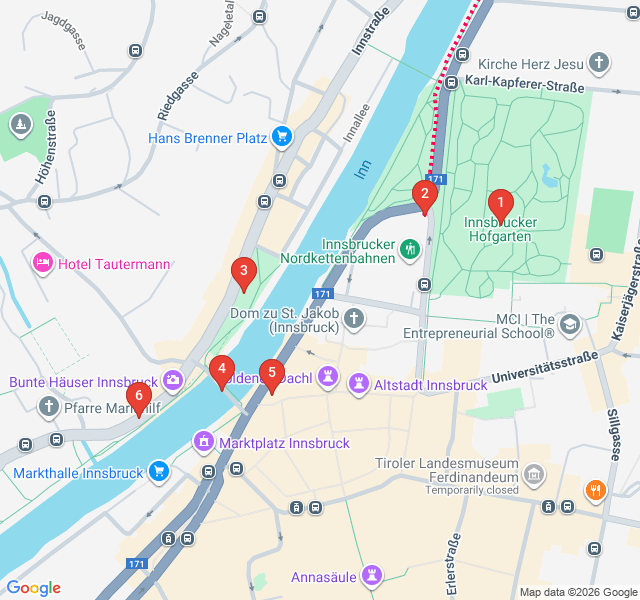
Numbers indicate the order of stops on the tour.
Welcome to the Hofgarten, the imperial 'back garden' of the Hofburg Palace. Originally laid out in the 16th century under Archduke Ferdinand II, this space has evolved from a Renaissance garden into the English landscape style you see today. For photographers, this is a masterclass in framing. Look how the manicured lawns and ancient trees—some planted by Empress Maria Theresa herself—contrast with the rugged, grey peaks of the Nordkette mountains. The glass pavilion here is a favorite for capturing reflections. This park has served the Habsburg royalty for centuries, and today it offers a peaceful, green threshold to your riverside exploration. Take a moment to capture the symmetry of the paths before we head toward the future of Tyrolean design.
Standing here, you are looking at a masterpiece of contemporary architecture. Designed by the world-renowned Zaha Hadid and completed in 2007, the Hungerburgbahn stations are meant to mimic the glaciers and ice formations found in the high Alps. The fluid, organic shapes of the white glass roofs seem to float above the concrete bases. This is a prime spot for architectural photography; the way the sunlight plays off the curved surfaces creates dynamic shadows throughout the day. It represents Innsbruck’s unique identity: a city that honors its mountain heritage while embracing bold, modern innovation. You don't need to board the train to appreciate the genius of the design, but the station itself provides a perfect foreground for the mountains behind it.
As you enter Walther Park, the city opens up to the Inn River. This small green space offers one of the most balanced views of Innsbruck. To your right, the Old Town’s towers rise above the rooftops, and directly ahead, the river flows with its characteristic milky-green color, a result of glacial silt. This is the 'Innsbruck skyline.' Photographers often flock here to capture the scale of the Nordkette mountains as they appear to drop directly into the city streets. The park is named after Walther von der Vogelweide, a famous medieval lyric poet, adding a layer of literary history to this scenic vista. It's a perfect spot to observe the locals cycling along the river path while you frame your shot of the alpine horizon.
You are now standing on the very spot that gave Innsbruck its name—literally 'the bridge over the Inn.' While the current structure is modern, a bridge has existed here since at least the 12th century, facilitating trade across the Alps. This is perhaps the most famous photography location in the city. Facing west, you have the quintessential view of the Mariahilf houses. The bridge itself provides a stable platform to capture long-exposure shots of the rushing river. Look down at the water; the speed of the Inn is a reminder of the power of the snowmelt from the surrounding peaks. This crossing was once the only way to reach the northern territories from the city center, making it the historical heart of Tyrolean commerce.
Guarding the entrance to the Altstadt is the Ottoburg, a late-Gothic residential tower that looks like something out of a fairy tale. Built into the former city walls in the late 15th century, its red-and-white shutters are a classic symbol of Innsbruck. The building has survived centuries of change, including the dismantling of the city's fortifications. For a great photo, try to capture the building from a low angle to emphasize its height against the narrow entrance of Herzog-Friedrich-Straße. It currently houses a historic restaurant, but its exterior remains one of the best-preserved examples of medieval secular architecture in the region. The texture of the stone and the vibrant shutters offer a wonderful contrast to the modern river views you just experienced.
Our walk concludes on Mariahilfstraße, the street that provides Innsbruck with its most iconic splash of color. This row of houses, with their varied heights and pastel facades, dates back to the medieval era when this was a district for artisans and laborers. Today, it is one of the most sought-after views in the Alps. To get the best shot, walk a little further down the river bank and look back toward the city. The reflection of these colorful homes in the Inn River, with the mountains towering behind them, is the definitive Innsbruck photograph. It’s a reminder that even the most functional parts of the city—residential housing—were built with an eye for beauty and harmony with the surrounding landscape.
Start Free on iPhone
Explore “Colors of the Inn: A Photographer's Riverside Route” with your very own Private Tour Guide with Zigway. Start free on iPhone, skip the large group and the fixed routes, and hear the city come alive as you go.
Your Private Tour Guide
Don't miss the good stuff
Explore Freely
 Easy
EasyInnsbruck, Austria
Discover the flavors of Tyrol on this self-guided stroll through Innsbruck’s historic Old Town and vibrant market hall.
 Easy
EasyInnsbruck, Austria
Uncover the myths and legends of Innsbruck on this self-guided walk through the historic Altstadt and beyond.
 Easy
EasyInnsbruck, Austria
Discover Innsbruck's evolution from Gothic roots to Zaha Hadid's futuristic designs on this self-guided architectural walking route.
 Challenging
Innsbruck, Austria
Scale the sun-drenched slopes of Hötting on this self-guided walk featuring panoramic Alps views, steep historic streets, and hidden forest chapels.
 Easy
EasyNairobi, Kenya
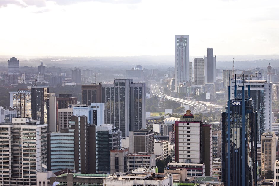
Discover Nairobi's iconic skyline on this self-guided architecture walk through the CBD’s most famous modernist and Brutalist landmarks.
 Moderate
Krakow, Poland
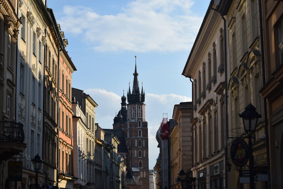
Discover Krakow’s stunning skyline and riverside charm on this self-guided audio walk through scenic viewpoints and historic mounds.
 Easy
EasyWarsaw, Poland
Explore Warsaw's scenic riverfront, rooftop gardens, and industrial-chic architecture on this self-guided stroll through the Powiśle district.
 Easy
EasyWarsaw, Poland
Discover Warsaw's intellectual heart through historic campuses, peaceful parks, and the stunning rooftop gardens of the University Library.
 Easy
EasyVienna, Austria
Explore Vienna’s vibrant open-air gallery along the Danube Canal on this self-guided street art and nightlife stroll through Leopoldstadt.
 Moderate
Vienna, Austria
Follow the footsteps of Mozart and Strauss through Vienna’s historic center on this self-guided walk through the city's rich musical history.
 Moderate
Vienna, Austria
Discover the noir world of The Third Man and Cold War Vienna on this atmospheric self-guided audio walk through the historic Innere Stadt.
 Easy
EasyVienna, Austria
Discover the literary haunts and architectural gems of Vienna's legendary coffee culture on this self-guided stroll through the historic city center.
