Self-guided audio tour in San Francisco
Start Free on iPhone
Start free on iPhone to unlock this self-guided walking tour in San Francisco. Hear all the stories that make it amazing, walk at your own pace, and begin whenever you want.
Your Private Tour Guide
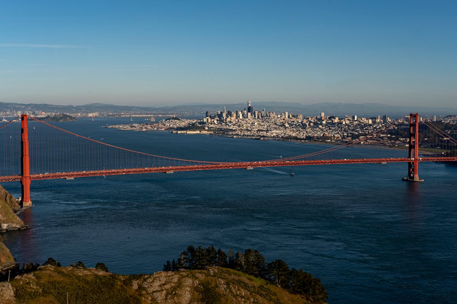
San Francisco is a city defined by its verticality, and nowhere is this more evident than on the journey from the historic Castro district to the windswept heights of Twin Peaks. This self-guided walk offers a rigorous but rewarding ascent through some of the city's most charming hidden corners and breathtaking vistas. Unlike a traditional walking tour San Francisco visitors might take through the flat Embarcadero, this route embraces the 'City on the Edge' theme, leading you through secret community gardens, residential stairways, and rugged hilltop parks that many locals don't even know exist. Your journey begins at the bustling heart of the LGBTQ+ movement before quickly transitioning into the quiet, steep residential streets that characterize the city’s interior. Along the way, you will discover the whimsical Seward Street Slides, a testament to neighborhood activism, and the serene Corwin Street Garden. As the elevation increases, the urban density thins, replaced by the coastal scrub and rocky outcrops of Kite Hill. The final push brings you to the iconic Twin Peaks, the second-highest points in the city. From here, the entire Bay Area unfolds in a 360-degree panorama, offering views that stretch from the Golden Gate Bridge to the Bay Bridge and beyond. This walking route is designed for those who want to experience the true topography of the peninsula. While a guided tour San Francisco offers might stick to the tour buses, this independent trek allows you to feel the change in temperature, hear the wind whistle through the peaks, and watch the fog roll through the Golden Gate at your own pace. It is a photography-focused adventure that rewards physical effort with the most iconic skyline views in Northern California. Prepare for steep inclines and variable weather, as this neighborhood stroll eventually becomes a true nature hike in the heart of the city.
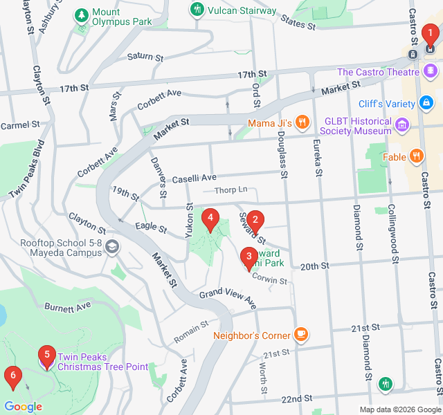
Numbers indicate the order of stops on the tour.
Welcome to the starting point of your ascent. This plaza is dedicated to Harvey Milk, the first openly gay elected official in California history. The Castro served as a beacon for the LGBTQ+ community in the 1970s and remains a vibrant cultural hub today. Look up at the massive rainbow flag flying over the intersection—it serves as a landmark for the neighborhood's identity. As you begin your walk, you'll be leaving the bustling shops and historic theaters behind to climb into the residential heights. This area was once known as 'Little Scandinavia' before its transformation in the late 20th century. Take a moment to soak in the energy of the street before we head toward the hills.
Hidden at the end of a residential cul-de-sac, these concrete slides are a quirky piece of San Francisco history. Built in 1973, they were the result of neighborhood activism; residents fought to turn this steep lot into a mini-park rather than an apartment complex. A local 14-year-old girl won a design contest for the park, resulting in the dual slides you see today. If you brought a piece of cardboard, you can test them out—just remember that the speed can be surprising! It's a perfect example of the city's 'keep it weird' spirit and a great spot to catch your breath before the climb gets steeper.
This tiny oasis is one of the city's many 'secret' gardens. Maintained by dedicated local volunteers, the Corwin Street Garden showcases native California plants and provides a habitat for local birds and butterflies. As you walk through, notice how the urban noise begins to fade, replaced by the rustle of leaves and the distant hum of the city below. The garden represents the transition from the manicured streets of the Castro to the more rugged, natural landscape of the peaks. It's a quiet moment of zen before we tackle the final, most challenging portion of the climb toward the summit.
You've reached Kite Hill, an open space that offers a fantastic 'mid-level' view of the city. From this grassy vantage point, you can clearly see the Mission District, the downtown skyline, and even the East Bay on a clear day. This park is a favorite for locals who want to escape the crowds of the more famous viewpoints. Historically, this area was part of the San Miguel Rancho, a massive Mexican land grant. Today, it serves as a critical corridor for urban wildlife. Take a moment to appreciate the scale of the city's grid system as it drapes over the undulating hills below you.
Named for the large holiday tree that used to be lit here in the early 20th century, Christmas Tree Point is the primary overlook for most visitors. Here, the view opens up completely. You can trace the path of Market Street as it cuts a straight line through the city toward the Ferry Building. To the north, the Golden Gate Bridge towers are often visible peeking through the fog. This is a popular spot for photography, especially as the city lights begin to twinkle at dusk. While most people drive here, reaching it on foot gives you a unique appreciation for the sheer elevation of these peaks.
You have reached the summit! These two hills, known as 'Noe' and 'Eureka,' stand at roughly 922 feet. To the indigenous Ohlone people, these peaks were known as the 'Breasts of the Indian Maiden.' Geologically, the rock beneath your feet is Franciscan Chert—ancient seabed pushed upward by tectonic forces over millions of years. From this 360-degree vantage point, you can see the Pacific Ocean to the west and the entire San Francisco Bay to the east. The wind here can be fierce, but the perspective it provides on the 'City on the Edge' is unmatched. You've successfully navigated one of the most challenging urban hikes in America.
Start Free on iPhone
Explore “City on the Edge: The Twin Peaks Panorama Route” with your very own Private Tour Guide with Zigway. Start free on iPhone, skip the large group and the fixed routes, and hear the city come alive as you go.
Your Private Tour Guide
Don't miss the good stuff
Explore Freely
 Easy
EasySan Francisco, United States
Explore the epicenter of LGBTQ+ history on this self-guided walk through San Francisco's Castro district, from Harvey Milk's legacy to iconic cinema.
 Easy
EasySan Francisco, United States
Explore the historic Barbary Coast waterfront, from the iconic Ferry Building to the vintage arcades and sea lions of the Embarcadero.
 Moderate
San Francisco, United States
Discover hidden art, cinematic history, and historic forts on this self-guided walk through the Presidio’s lush forests and coastal trails.
 Easy
EasySan Francisco, United States
Explore San Francisco’s architectural evolution from historic Art Deco gems to modern glass skyscrapers on this self-guided walking route.
 Moderate
Nairobi, Kenya
Discover Nairobi's lush side on this self-guided walk through botanical gardens, historic memorials, and vibrant local markets.
 Moderate
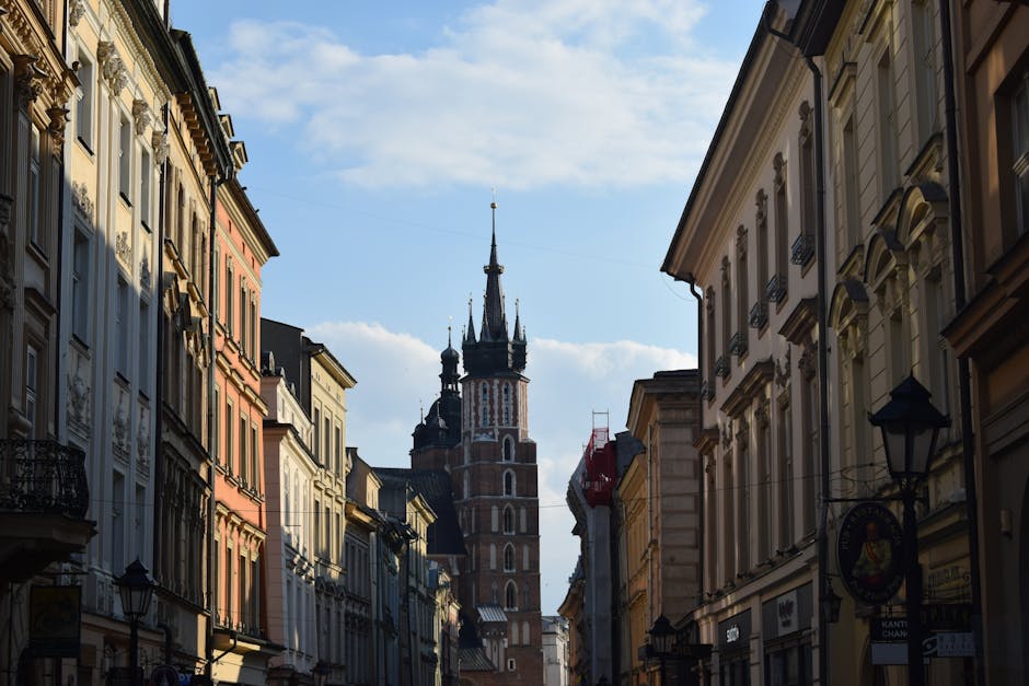
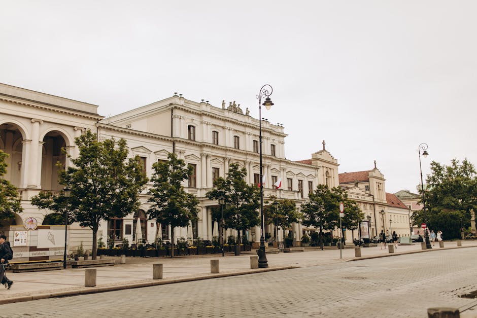
Krakow, Poland
Discover Krakow’s stunning skyline and riverside charm on this self-guided audio walk through scenic viewpoints and historic mounds.
 Moderate
Gdansk, Poland
Discover Zaspa, a massive open-air gallery where grey housing blocks are transformed by over 60 monumental murals. Explore at your own pace.
 Easy
EasyWarsaw, Poland
Explore Warsaw's scenic riverfront, rooftop gardens, and industrial-chic architecture on this self-guided stroll through the Powiśle district.
 Easy
EasyNashville, United States
Explore the 'Athens of the South' on this self-guided walk through Centennial Park, featuring the world's only full-scale Parthenon replica.
 Easy
EasyNashville, United States
Explore Nashville's academic heart and Art Deco gems on this self-guided walk through historic Hillsboro Village.
 Easy
EasyNashville, United States
Explore the heart of Nashville's music industry. Discover iconic studios and the history of the legendary Nashville Sound at your own pace.
 Easy
EasyNashville, United States
Explore Nashville's oldest neighborhood! Discover Victorian architecture, Civil War history, and world-class craft beer on this self-guided walk.